2025-2026 Timeline
- Call for proposals: October 9 - November 10, 2025
- Pre-application meeting: Wednesday, October 22, 12:00 - 1:00 PM
- Award notification: Late November 2025
- Funding: December 2025 / January 2026
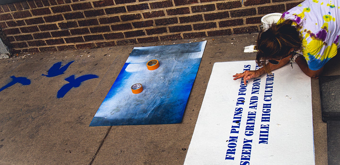
Bluebird Haiku project | P.S. You Are Here - Photo courtesy of SharedViews Media
![]()
Identify Project Ideas and Potential Partners
Reach out, raise awareness, and encourage participation with the local neighborhood groups, businesses, organizations and/or engaged residents to identify an opportunity in the community, and to develop a collaborative, community-driven project.
Contact the Council District Offices for ideas about organizations and sites suitable for proposals. Check out the map to find out which Council District your project could be in: https://www.denvergov.org/maps/map/councildistricts
Review the list of Registered Neighborhood Organizations
Consider community dynamics and local history in your area.
Budget
When developing your budget, be sure to show projected income and expenses, and identify in which areas the grant funding would be utilized:
Income
Grant request amount
Additional funding sources, if any (crowdfunding, sponsorships, in-kind donations, additional grant funds, etc.)
Volunteer hours (valued at $20/hour)
Expenses
Project Management and Planning
Supplies
Art and Design services
Permits
Traffic Control
Considerations for Public Spaces
Here are some additional considerations to be aware of when creating a proposal, some of which may require additional permitting, design, engineering, approvals, or other considerations. Our P.S. You Are Here committee can help through these implementations and planning needs.
Proposals in Denver Parks and/or Recreation Centers will require a Temporary Construction Access Permit (TCAP) as well as additional reviews from DPR staff.
Street painting projects proposed for functional streets will require an additional review process through the Community Streets program.
Any proposal in public right-of-way (public streets, intersections, sidewalks, trails, alleys) will require a review and approval from the Department of Transportation and Infrastructure (DOTI).
Due to time required and difficulty in coordination, proposals involving utilities and rail lines are not recommended.
Applicants are responsible for any maintenance required during the project’s display.
Consider what happens at the end of the project. How will the project be de-installed? Will it be adopted by your group or some other organization? Who will maintain the project?
Safety first; be sure your projects are designed well and are structurally sound for the duration of display.
Insurance & Liability Coverage Requirements
Some level of insurance will likely be required depending on the scope of work and location of your project. Our team will help you navigate this process:
Workers’ Compensation - State-mandated coverage for employees injured on the job. Colorado Workers’ Compensation law requires any business with one or more employees to carry this type of insurance. Sole Proprietors (those with no employees) are not required to carry Workers’ Compensation. It is important to notify the City if this rule applies to you.
Business Auto Liability - Coverage for liability (negligence) claims by a third party related to the operation of an automobile. Auto insurance is required of all contractors who will be operating a vehicle as part of their contractual duties for the City. The standard limit required is $1,000,000. Contractors who use their personal vehicles can substitute their personal auto insurance for the business auto requirement. It is important to notify the City if this rule applies to you.
General Liability - Coverage for liability (negligence) claims by a third party related to bodily injury (injury to another person) or property damage (damage to another person’s property). Limits will vary depending on the scope of work. Minimum limit is generally $1,000,000.
Professional Liability - Coverage for claims related to a "professional’s" error in judgment, planning or design. Examples of work requiring professional liability are architectural designs and engineering studies. NOTE: if a third party is hired to do such work, that third party is allowed to carry the insurance.
To determine what type of insurance is required, final grantees will need to provide a Project Risk Assessment Form on:
What is the scope of work? (medium, materials, weight, size)
How many people are part of the process from inception to completion?
Are these people employees or all sole proprietors?
Is specialized/certified knowledge required of the project such as engineering studies or architectural renderings?
How will it be installed; where will it be installed; who will be installing it?
Will the public have access to the space during the installation?
What, if any, special equipment is necessary to install and who will be handling the equipment?
Remember, projects must be in public space(s), defined as an area that is free and open to the public, such as an alley, park, plaza, or street owned and maintained by the City and County of Denver.
Maps
Map of Denver Neighborhoods: https://denvergov.org/maps/map/neighborhoods
Denver Council Districts: https://denvergov.org/Maps/map/councildistricts
Map of Denver Parks: www.denvergov.org/maps/map/parks
Interactive Map of Property Owners: https://property.spatialest.com/co/denver#/map/search/
Denver Bike Map: https://www.denvergov.org/Government/Agencies-Departments-Offices/Agencies-Departments-Offices-Directory/Department-of-Transportation-and-Infrastructure/Programs-Services/Bicycles/Bike-Map
Denver GIS Maps (maps showing a variety of urban data): https://www.denvergov.org/MAPS
Neighborhoods
Registered Neighborhood Organizations: https://www.denvergov.org/maps/map/neighborhoodorganizations
Permitting and Design Standards
Department of Transportation and Infrastructure and Right of Way services permitting: (pwpermits@denvergov.org or 303-446-3759) https://denvergov.org/Government/Agencies-Departments-Offices/Agencies-Departments-Offices-Directory/Department-of-Transportation-and-Infrastructure/Documents/Right-of-Way-Permits
Americans with Disability Act (ADA) Design Standards: https://www.ada.gov/
Assistance may also be found by contacting the Denver Office of Disability Rights: https://www.denvergov.org/Government/Agencies-Departments-Offices/Agencies-Departments-Offices-Directory/Human-Rights-Community-Partnerships/Divisions/Disability-Rights
CDOT Special Use Permits: Contact Kirk Allen, Region 1 Permit Manager, State of Colorado Department of Transportation, at 303-757-9531 or kirk.allen@state.co.gov
RTD Permits: The RTD Use Permit application can be found on RTD’s website here: https://www.rtd-denver.com/doing-business-with-rtd/construction-engineering/row-agreements-permits/row-agreement-policy and then should be submitted to realproperty@rtd-denver.com
Application Checklist
Project Title & Overview
Detailed project description, including:
Key goals & features
Materials used
Intended public benefit or impact
Funding Request
Amount requested (up to $10,000)
Clear budget outlining how funds will be spent
Proposed Location(s)
Exact public space location(s) (must be city-owned/maintained)
Street addresses and/or cross streets
Explanation of site selection
City Council District(s) of proposed location
Community Connection & Relevance
Relationship to the community
How the project reflects, engages, or responds to area
What makes your project innovative or creative (artistic, social, environmental, or cultural, etc.)
Partners & Collaborators
List confirmed and potential partners, with:
Names, roles, contact information
Timeline & Maintenance Plan
Draft timeline from planning to de-installation
Installation plan and project duration
Plan for maintenance during display
Supplemental Materials & Supporting Docs (Up to 3 uploads)
Visuals, renderings, or sketches
Material list (ensure durability)
Examples of past work or relevant experience
Links to support materials (if applicable)
Optional, 2-minute video upload option
For more information contact:
Michael Chavez, Curator of Public Art Partnerships, Denver Public Art Program
CONTACT MICHAEL
Lisa Gedgaudas, Program Manager, Cultural Affairs
CONTACT LISA
Visit the PSYAH Guidelines
Check out previous P.S. You Are Here projects for inspiration!

Application coming soon!